

Antarctica
Celebrating 60 years of Mapping and Surveying in Antarctica
Click images for larger previews.
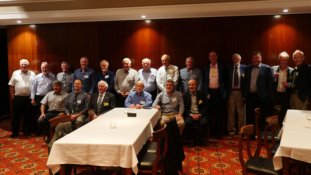
November 2018 | Wellington
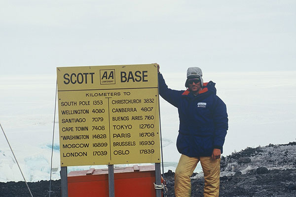
Since the establishment of Scott Base on Ross Island by the late Sir Edmund Hillary in 1957, surveyors have been appointed by the NZ Antarctic Research Programme to assist scientists with numerous survey related tasks on the Ice. Prior to 1992; two or more surveyors have visited Antarctica for the duration of each summer season. An overlap system was used each season (a surveyor from the previous season) to show the ropes for the new incoming surveyor.
In 1992 the NZ Antarctic Research Programme was restructured and re-branded to become the NZ Antarctic Programme. The budget (government funded) was severely tightened. A decision was made for only one surveyor to be appointed for the coming summer season and that the time spent on the Ice is to be shortened considerably.
Interest in being the Antarctic Surveyor is always keenly sought by surveyors throughout New Zealand. I was awarded the opportunity to become a “guinea pig” for the new system during the 1992-93 summer season, spending a total of 4½ weeks on the Ice.
Before visiting the Ice, it was compulsory to spend a week at the Balmoral Military Camp near Tekapo, a mid-winter training course used as an introduction to the “real” environment. Later en route to the Ice, I spent some time at the International Antarctic Centre in Christchurch, being kitted out in the appropriate Antarctic survival gear. All in all, 40kg of clothing and gear had to be stowed away in kitbags before the journey to the Ice aboard a United States Navy C-130 aircraft.
My first two days in Antarctica were spent on a compulsory Antarctic Field Training course. Being issued with crampons, prussiks, harness, karabiners and ropes, I joined five other trainees and the instructor. Travelling in a Hagglund All Terrain carrier we headed out onto the permanent ice shelf and then onto the sea ice to look at and study ice cracks.
We learnt how to build an igloo which usually takes approximately three hours in good conditions, using an ice saw and spade. Spending a night in our new accommodation, it was surprisingly warm and light inside; outside temperature was -14º Celsius.
I travelled in an ASV 2500 vehicle to Shackleton’s Hut, Cape Royds, 35 kms north of Scott Base. This was built by Ernest Shackleton in February 1908 and is now a historical monument administered by the Antarctic Heritage Trust. I carried out a series of levels to specified points on the historic hut, part of a monitoring project for possible movements. Similar exercises were done at two other historical huts, also administered by the Antarctic Heritage Trust. They were built by Captain Robert Falcon Scott also. Another was built at Hut Point, adjacent to the United States Antarctic base, McMurdo Station during McMurdo’s his first expedition in February 1902. McMurdo’s other hut was built at Cape Evans in January 1911. At Hut Point I carried out a full deformation survey of the hut, which is sinking and sliding towards the sea.
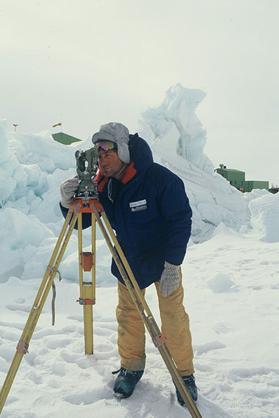
The next three days were spent around Scott Base undertaking several survey tasks, a topographical survey (extension to the Scott Base facilities). During this period a group of distinguished visitors arrived. They were the Governor General Dame Catherine Tizard and a Member of Parliament David Caygill. I also had the opportunity to visit New Zealand’s newest satellite station located at Arrival Heights.
From Scott Base to Cape Roberts, approximately 130 kilometres to the north-west, I was flown in by an American Iroquois helicopter. There I joined a Kiwi scientific camped on the sea ice. They were attempting to collect samples from the ocean floor using a corer through a hole drilled through the sea ice. My task was to fix these borehole positions. I also calibrated and monitored a tide gauge, taking readings every hour on the hour, for 25 hours.
The last day in the area, I went with two others from camp on skidoos into Granite Harbour to survey the current position of Mackay Glacier. When returning we stopped briefly at a historic rock shelter at Cape Geology, (constructed by Griffith Taylor, of Captain Scott’s party 1911).
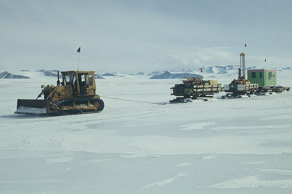
Returning to Scott Base involved a two day travel over the sea ice by “train”, a D5 bulldozer pulling two cantagos, a wannigan (small hut) and a smaller sledge. Two skidoos scouted ahead for the best, and safest, route through the sometimes uneven sea ice and to locate the most suitable crossing points over ice cracks that had open water (up to a metre wide.)
My last major trip in Antarctica was one of the most enjoyable for me. It involved taking levels on eleven lakes in the Dry Valleys and Koettlitz area on the main continent, directly west of Scott Base. I had at my disposal a RNZAF Iroquois helicopter and a helpful Kiwi crew. Work involved relating the levels of the lakes to nearby benchmarks, as part of a 20 year old project for the Institute of Geological and Nuclear Sciences.
We visited Lake Vanda, situated on the shore of this lake is a NZ Antarctic Programme remote station, for the first time in years, was not being manned throughout the summer season. This wannigan was to be removed the following season due to the significant ongoing rising of Lake Vanda. Another lake visited, Don Juan Pond, never freezes due to the high amounts of calcium chloride.
Just one survey job to complete, a seismic reflection line that had being laid out by another group of scientists along the permanent ice shelf near Scott Base. Conditions were not ideal for surveying with 30 knot winds, temperatures below – 20º Celsius and low visibility.
Finally I had the opportunity to participate in the annual “polar plunge”, a ritual to be endured before becoming a member of the Polar Plunge Swim Club. This involved shedding all clothing, attaching a rope around the body, and launching oneself into the sea through a hole in the ice, before making a fast exit up a ladder. Usually a Kiwi event, but plenty of Americans from the neighbouring McMurdo Station came to take part.
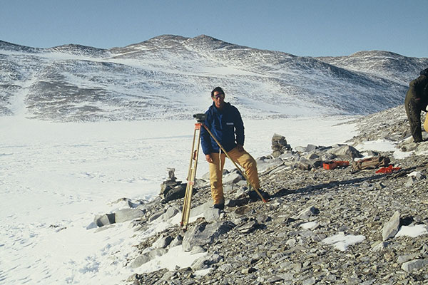
I undertook 16 different survey related projects. Being the Antarctic Surveyor on the Ice, one gets to travel around and visit far more places than the scientists themselves who travel to the Ice to undertake a particular project in one area, or the staff that are based mostly at Scott Base. Throughout the whole trip I had a variety of assistants to help with the survey tasks on hand, none had any prior surveying knowledge. During the whole period I was on the Ice, it was daylight for 24 hours and the sun never sets. I often found myself working into the early hours of the morning. It was important to ensure a routine was established to provide adequate rest, sleeping and eating in this very unusual working environment.
The following book refers to various surveyors that were involved on the Ice and the vital parts they played there, including my own visit during the 1992-93 summer season.
David L. Harrowfield, Call of the Ice: Fifty years of New Zealand in Antarctica, David Bateman Ltd, Auckland, 2007.